walking routes around wiston estate
58 KILOMETERS OF FOOTPATH & BRIDLEWAY TO DISCOVER
CLICK HERE TO DOWNLOAD OUR VINEYARD WALKS MAP
Panoramic views of the South Downs are the reward for all ramblers in inland West Sussex. Rolling chalk hills provide tough terrain for both legs and roots, but there are leisurely walks and picnic spots aplenty too. We’ve gathered four walks from easy to medium to challenging, listed by distance, that we’d recommend to visitors to Wiston Estate. Walks in West Sussex are a great way to see local wildlife, and we’ve highlighted spots where, if you’re lucky, you can see newts, hares and wild birds. All our walks start at Wiston Estate’s North Farm or the Chanctonbury Ring Car Park.
Crossroads Viewpoint
Time: 20 minutes
Distance: 1.3 km / 0.8 miles
Elevation gain: 27 m/ 88 ft
A short, gentle climb from North Farm will reward you with spectacular views overlooking the South Downs and beyond to the sea.
Starting at the winery car park, walk straight up the hill and take a right at the track which runs above North Farm Vineyard. A 10-minute stroll onwards will take you to Crossroads Viewpoint.
At this point, you can see two of the most prominent hills in this area of the South Downs. Wiston Estate’s own Chanctonbury Ring, instantly recognisable by the throng of beech trees upon its top, lies to the North-East, across the valley in front of you on the left-hand side, while the broader, undulated top of Cissbury Ring is clearly visible to the South-East. From Iron Age forts to Roman religious sites and settlements, these landmarks have revealed much about generations past. Now, they are cherished by the local community and provide important sites for wildlife conservation. To the right of Cissbury Ring is the small village of Findon. On a clear day, you can see directly past Findon to Worthing seafront and the English Channel beyond.
Wiston Winery Chanctonbury Loop
Time: 1 hour 35 minutes
Distance: 7.9 km/ 4.9 miles
Elevation gain: 269 m/ 883 ft
Start at North Farm Vineyard by the Chalk car park and head through the gate with the sheds on your left, and turn right. Head straight along the chalky track. Go straight over the ‘crossroads’ – if the weather is good you’ll see the sea down to your right. Follow this track down the steep chalk hill until you reach the barns on your right. Go up the chalk road a little, then take the left fork of the footpath, following the track through the trees where you will pass behind our original vineyard and wine barn (with these on your left). You will get to a small wooden gate, go through this and continue through the valley to join the track on the other side (there should be a small blue arrow to point you in the correct direction of the valley). Carry on up through the small woods, and keep heading uphill on the narrow, grassy track until you reach a crossroads at the top. Take in the spectacular 360 degree views, then turn left down the wide chalk track. Continue along the path, past the cattle grid until Chanctonbury Ring is in sight.
You are now on top of Chanctonbury Hill, a site which has been inhabited and cherished by generations past and witnessed thousands of years of human development. Continue along the path towards the copse of trees ahead: Chanctonbury Ring. The original beech trees, planted in 1760 by Charles Goring, were ravaged by the great storm of 1987. With three quarters of the original trees lost, a huge replanting effort has restored the iconic throng which makes Chanctonbury Hill so unique and instantly recognisable. Feel free to stop at one of our picnic areas on the way to rest and admire the view.
With the Chanctonbury Ring trees on your right, ensure you bear left and continue to the cattle grid. Follow this steep chalky track all the way down the hill, admiring the spectacular views. You’ll find yourself back at Crossroads Viewpoint at the top. Turn right and continue down the hill to return to North Farm.
Washington & Chalk Loop
Time: 1 hour
Distance: 5.11 km/ 3.17 miles
Elevation gain: 234 m/ 767 ft
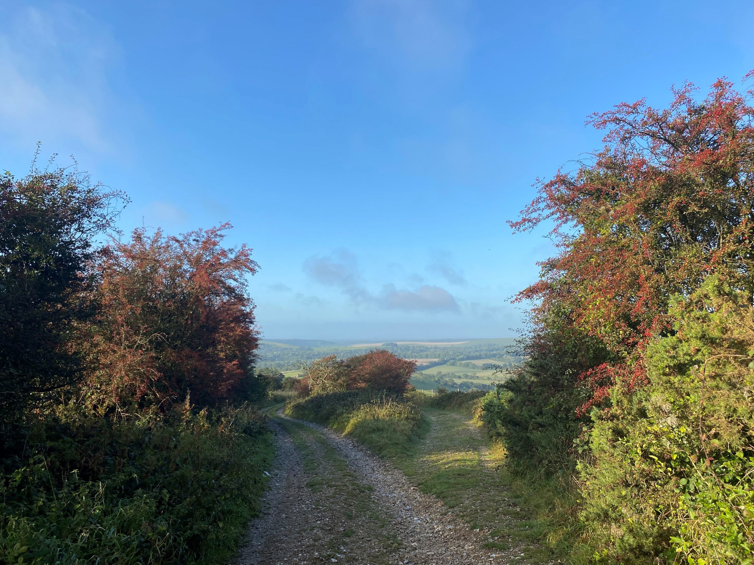
Berries Autumn View at Wiston
Start at the Chalk car park. Head up the hill and take the left footpath where it is signposted. Go through the back of North Farm and head north alongside the road. The first 10 mins or so is along parallel to the A24 which is a bit of a downside but as soon as you hit the Washington car park you head away from the road – turn right and head up the footpath. Lovely climb up the hill. Do look back to see great views to the north west. When you hit the top turn south (right) and take the chalky path downhill. You get stunning views of Chanctonbury and Cissbury Rings, and down to the coast towards Worthing.
Head down the hill until you reach a crossroads, turn right, and you will find yourself back at North Farm and Chalk.
Chanctonbury Ring Loop from Chanctonbury Car Park
Time: 1 hour
Distance: 4.39 km/ 2.72
Elevation gain: 175m
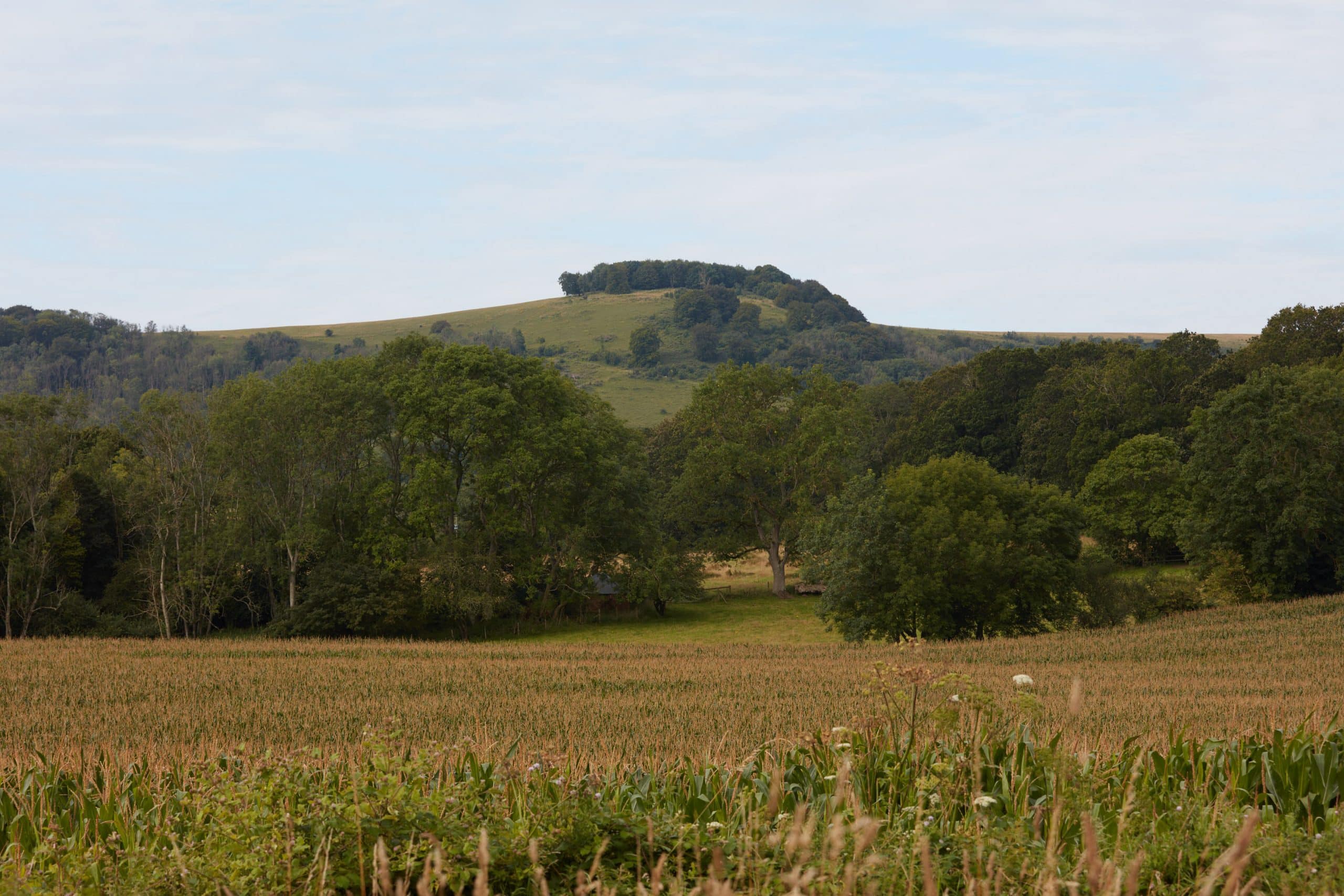
Chanctonbury Ring on Wiston Estate
Start at the Chanctonbury Ring Car Park and turn left out of it towards the hills. Head up the pathway which takes up through the woodlands – beautiful wide path with ancient woodland as you walk up the hill. The path will lead you up and when you pop out at the top you will find yourselves at a crossroads on the South Downs Way. Turn right to head up to Chanctonbury Ring. After you’ve taken in the Chanctonbury Ring views, bear right off the main South Downs Way path. This path then heads through a gate and down a steep hill into the woods. When you hit a junction, turn right and walk along the woodlands path, which will eventually bring you out by the road with the car park on.
Monarch’s Way Loop from Chanctonbury Car Park
Time: 2 hourS
Distance: 9.6 km
Elevation gain: 298m
Start at the Chanctonbury Ring Car Park and turn left out of it towards the hills. Head up the pathway which takes up through the woodlands – beautiful wide path with ancient woodland as you walk up the hill. The path will lead you up and when you pop out at the top you will find yourselves at a crossroads on the South Downs Way. Head straight across the crossroads and continue south. You will see the sea and Cissbury Ring appear in front of you as you progress along the path. When you hit the next crossroads, take the path marked Monarch’s Way – left, with the sea on your right. Continue along Monarch’s Way. After a little way you will go down and then up a steep slope – look back for great South Downs views. Eventually at the top of this hill you will rejoin the South Downs Way at a crossroads. Turn left and go along the South Downs Way, until you reach the original crossroads at the top of the woods. Head back down the chalk path you started on to return to the car park.
